 Batu Gajah, Perak (18 September 2016)
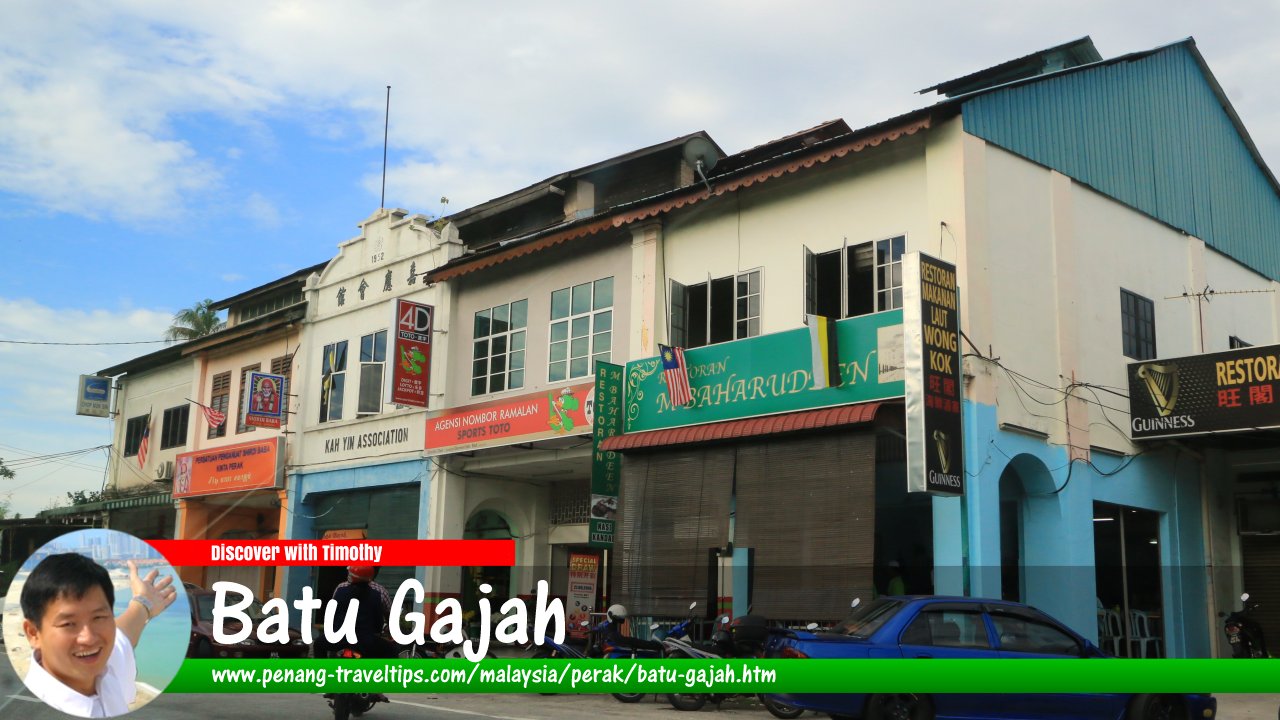
Batu Gajah (GPS: 4.47066, 101.04228) is a town in the Kinta district, a short distance south of Ipoh. Batu Gajah is a town in Perak, Malaysia. It today has a population of about 35,000 (2011 estimate). The town of Batu Gajah straddles the Kinta River, a few kilometers to the south of its confluence with Sungai Pinji. As with many towns in Perak, Batu Gajah had its heydays in the late 19th century, when it was a major tin producing town. Since then, with the tin deposits depleted, the town has become a quiet place for pensioners.
The area was densely forested until the mid 19th century, when tin prospectors began arriving up the Kinta River from Teluk Intan. By the 1880's, the tin mines in Papan was yielding large quantities of ore, and Batu Gajah was selected as the site for a river port on the Kinta River.
Map of Batu Gajah
Categories of sights in Batu Gajah
Places of Interest in Batu Gajah
- Anglican Christian Cemetery (GPS: 4.47873, 101.03211)

- Arulmigu Maha Mariamman Temple (GPS: 4.4737, 101.08149)

- Batu Gajah Clock Tower (GPS: 4.47235, 101.04103)

- Batu Gajah Hospital (GPS: 4.47937, 101.03415)

- Batu Gajah Prison (GPS: 4.47882, 101.03335)

- Church of St Joseph (GPS: 4.4812, 101.03573)

- Guandi Temple (GPS: 4.46575, 101.04341)

- Holy Trinity Church (GPS: 4.47929, 101.03247)

- Kellie's Castle (GPS: 4.47437, 101.08778)

- Kinta District Administrative Complex (GPS: 4.47716, 101.03551)

- Masjid Batu Gajah (GPS: 4.46895, 101.04324)

- Menara Tanjak (GPS: 4.4737, 101.05291)

- Pusat Rawatan Haemodialysis Wan Nong (GPS: 4.47915, 101.033)

- San Huang Dong Temple (GPS: 4.46716, 101.04375)

Petrol Stations in Batu Gajah
- Bhpetrol Batu Gajah (GPS: 4.47994, 101.03926)

- Caltex Jalan Pusing (GPS: 4.47726, 101.04104)

- Shell Jalan Pusing (GPS: 4.47281, 101.04225)

Nearby Towns
Jalan Sungai (River Road) was one of the first roads built in Batu Gajah. From there, the town (now Old Town, or Pekan Lama) was laid out. The early inhabitants of Batu Gajah were mostly Malays as well as Mandailings from Sumatra. They were later joined by Chinese and Indians. The name Batu Gajah means "elephant rock". There are a few stories as to how the place got its name. The first refers to two large rocks that look like elephants located on the Kinta River. However, there are no such rocks to be seen in the river today. Another theory is that elephants are often seen rubbing their bodies against the boulders along the Kinta River.
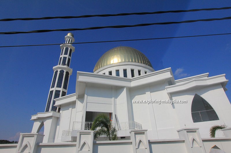
 New Batu Gajah Mosque (18 June 2011)
Another story related to Batu Gajah tells of a "orang halus" (local elf) named Sang Gedembai who could turn the things it sees into stone. According to the legend, two elephants crossing the Kinta River stumbled upon Sang Gedembai and were turned into boulders.
Yet another storey related to Batu Gajah was documented by Kinta District Officer H.A. Luckam in 1949. The story was told to him by the acting penghulu of Sungei Terap, in which district Batu Gajah was then located. In the story, a group of Buddhist pilgrims were on their way from Teluk Intan when they arrived in the Batu Gajah area. They carved two stones to resemble elephants, in order to set them up as a landmark as well as a place of worship.
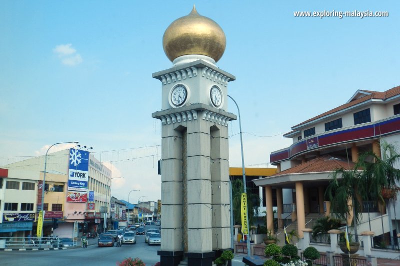
 Batu Gajah Clock Tower (18 June 2011)
Batu Gajah was originally a cluster of villages within the county (mukim) of Sungai Terap. There was a village here by the name of Kampong Sungei Terap, which was founded by Toh Panjang Bongkok. He was later conferred the title of Sri Amar DiRaja by the 19th Sultan of Perak, Sultan Abdul Malik Mansur Shah. The first British Resident in Perak, JWW Birch, visited Batu Gajah on 30 April, 1875.
Batu Gajah became an important town in the Kinta Valley when it was selected as the port town for the shipment of tin mined in Papan. The oldest buildings are those off Jalan Sungai (River Street), which had businesses owned by Malays and Mandailing people, until the tin mining activities brought substantial numbers of Chinese and Indians. The original part of town, located near the Kinta River, is today called Pekan Lama, or Old Town.
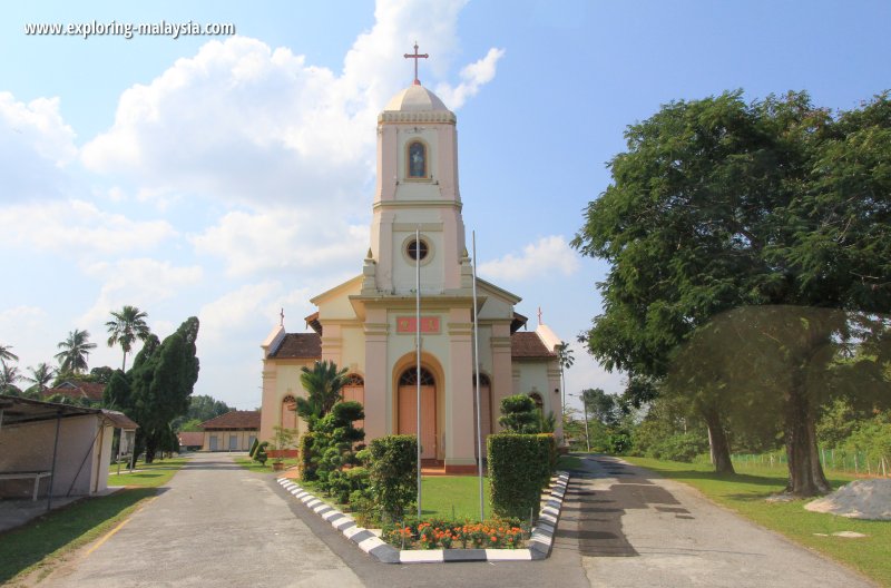
 St Joseph's Church, Batu Gajah (18 June 2011)
The British established their administrative on a tableland which is today the Changkat neighbourhood of Batu Gajah. There, they built the Kinta District Administrative Office (1884), the Batu Gajah Hospital (1890's) and the Batu Gajah Prison (1888), where Sybil Kathigasu was incarcerated during the Second World War.
Getting there
Exit the North South Expressway at the Gopeng Interchange (Exit 135), then drive heading west on Jalan Gopeng (A8) until you reach Batu Gajah.Batu Gajah is  on the Map of towns in Perak
Bibliography
- Kinta Valley - Pioneering Malaysia's Modern Development, by Khoo Salma Nasution & Abdur-Razzaq Lubis, published by Perak Academy ISBN 983-42113-0-9
Back to Perak mainpage; list of Towns in Perak and Towns in Malaysia
 Latest updates on Penang Travel Tips
 Discover with Timothy YouTube Channel
 PG Food Channel
 Learn Penang Hokkien YouTube Channel
 SojiMart Videos
Latest from Discover with Timothy: Gurney Bay - what to see and do there
About this website

Hello and thanks for reading this page. My name is Timothy and my hobby is in describing places so that I can share the information with the general public. My website has become the go to site for a lot of people including students, teachers, journalists, etc. whenever they seek information on places, particularly those in Malaysia and Singapore. I have been doing this since 5 January 2003, for over twenty years already. You can read about me at Discover Timothy. By now I have compiled information on thousands of places, mostly in Peninsular Malaysia and Singapore, and I continue to add more almost every day. My goal is to describe every street in every town in Malaysia and Singapore.
Robbie's Roadmap
- Episode 1: Robbie's Journey to Financial Freedom
- Episode 2: Lost in America
- Episode 3: The Value of Money
- Episode 4: The Mentor
- Episode 5: The Thing that Makes Money
- Episode 6: The walk with a Billionaire
- Episode 7: The Financial Freedom Awakening
- Episode 8: Meet Mr Washington
- Episode 9: The Pizzeria Incident
Copyright © 2003-2024 Timothy Tye. All Rights Reserved.


 Go Back