Human habitation in the Kisarazu area can be traced to the Japanese Paleolithic period. The present city however was founded much later. It began as a village around 1871, and was given town status in 1889. It developed as a base for Japanese military activities in the 1930s. After the defeat of Japan, the base was used by the US Air Force from 1945 until 1956. Kisarazu was given city status in 1942.
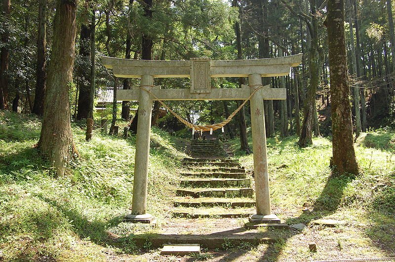
 The torii of Shiroyama Shrine at Mariyatsu Castle, Kisarazu, Chiba Prefecture
Source: http://commons.wikimedia.org/wiki/File:Mariyatsu-Castle_Shiroyama-Jinjya_Torii.JPG
Author: Kentagon

Planning your trip to Kisarazu
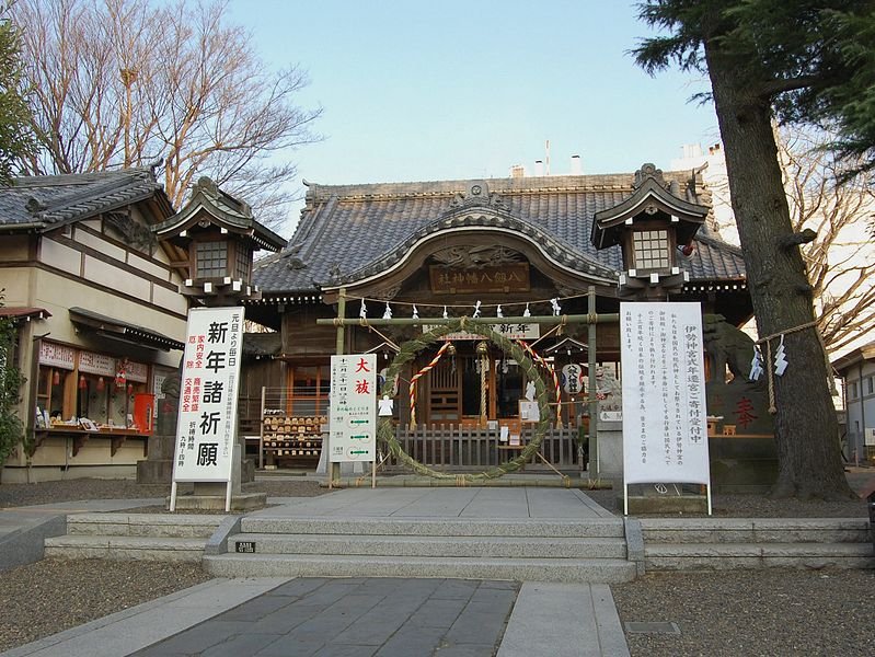
Two lines of the Japan East Railway serve Kisarazu. They are the Uchibo Line, which stops at the Iwane and Kisarazu stations and the Kururi Line, which stops at the Kisarazu, Chiba, Kazusa-Kiyokawa, Higashi-Kiyokawa and Makuta stations. A number of highways serve Kisarazu including the Tateyama Expressway, the Tokyo Bay Aqua-Line, the Ken-O Expressway and Japan National Routes 16, 127, 409 and 410. Yatsurugihachiman Shrine, Kisarazu, Chiba Prefecture
Source: http://commons.wikimedia.org/wiki/File:YaturugiHachiman-01_Kisarazu.jpg
Author: Kentagon

Places of Interest in Kisarazu
- Enmyo-in Temple
- Kozo-ji Temple
- Mariyatsu Castle
- Nakonoshima Park
- Odayama Park
- Yatsurugihachiman-jinja Shrine
 Latest updates on Penang Travel Tips
 Discover with Timothy YouTube Channel
 PG Food Channel
 Learn Penang Hokkien YouTube Channel
 SojiMart Videos
 Share your travels and/or ask a travel-related question
Join the Penang Travel Tips Facebook Group to share photos, tips and anything related to your travels, or ask travel-related questions.
 Map of Roads in Penang
Looking for information on Penang? Use this Map of Roads in Penang to zoom in on information about Penang, brought to you road by road. Discover with Timothy
Let me take you to explore and discover Penang through my series of walking tours on YouTube. You may use these videos as your virtual tour guide. At the beginning of each video, I provide the starting point coordinates which you may key into your GPS, Google Maps or Waze, to be navigated to where I start the walk, and use the video as your virtual tour guide.Disclaimer
Please use the information on this page as guidance only. The author endeavours to update the information on this page from time to time, but regrets any inaccuracies if there be any.Latest from Discover with Timothy: Gurney Bay - what to see and do there
About this website

Hello and thanks for reading this page. My name is Timothy and my hobby is in describing places so that I can share the information with the general public. My website has become the go to site for a lot of people including students, teachers, journalists, etc. whenever they seek information on places, particularly those in Malaysia and Singapore. I have been doing this since 5 January 2003, for over twenty years already. You can read about me at Discover Timothy. By now I have compiled information on thousands of places, mostly in Peninsular Malaysia and Singapore, and I continue to add more almost every day. My goal is to describe every street in every town in Malaysia and Singapore.
Robbie's Roadmap
- Episode 1: Robbie's Journey to Financial Freedom
- Episode 2: Lost in America
- Episode 3: The Value of Money
- Episode 4: The Mentor
- Episode 5: The Thing that Makes Money
- Episode 6: The walk with a Billionaire
- Episode 7: The Financial Freedom Awakening
- Episode 8: Meet Mr Washington
- Episode 9: The Pizzeria Incident
Copyright © 2003-2024 Timothy Tye. All Rights Reserved.


 Go Back