
Dujiangyan 都江堰
 Go Back - Latest Sichuan Province > China > Asia > World | YouTube : Facebook | About Me : Contact Me
 Dujiangyan Irrigation System (19 October, 2005)
The Dujiangyan Irrigation System 都江堰 is a historical Chinese irrigation system that was constructed around 250 BC by the Governor Li Bing (and his son) of Shu Prefecture in Qin State. It is located in Dujiangyan, 56 km west of present day Chengdu. Today, over two thousand years later, the Dujiangyan Irrigation System still supplies water. The system works by diverting part of the Minjiang River into an aqueduct leading to Chengdu. In 2000, it was made a World Heritage Site along with Mount Qingcheng.
 is diverted by the Dujiangyan aqueduct to supply water to Chengdu.") The Fish Mouth Levee: water of the Minjiang River (at left) is diverted by the Dujiangyan aqueduct to supply water to Chengdu (19 October 2005)
The Fish Mouth Levee: water of the Minjiang River (at left) is diverted by the Dujiangyan aqueduct to supply water to Chengdu (19 October 2005)
World Heritage Site Inscription Details
Location: N31 0 6.012 E103 36 19.008Inscription Year: 2000
Type of Site: Cultural
Inscription Criteria: II, IV, VI
Sights within Dujiangyan
To build the Dujiangyan Irrigation System, Li Bing had to cut a path through Mount Yulei on the bank of the Minjiang River. This is accomplished before the invention of explosives by repeatedly heating and cooling the rock to crack and weaken it. The Dujiangyan irrigation system also includes a dike in the middle of the river and spillways to help reduce the silt that flows into the aqueduct. The spillways allow excess water to continue down the Minjiang River in order to prevent the flooding of the Chengdu basin. Thus, in addition to supplying water, the system also prevents flooding.
Due to the Dujiangyan Irrigation System, the amount of irrigated area was expanded from 126,000 hectares to nearly 660,000 hectares covering 36 counties.
The Dujiangyan Irrigation System consists of three main parts:
In the 2008 Sichuan Earthquake (also called the Wenchuan Earthquake after the county in its epicenter) that happened on 12 May 2008, the "Fish Mouth" of the ancient Jujiangyan Irrigation System suffered some cracks but was otherwise undamaged.
 The Feishayan spillway of the Dujiangyan Irrigation System (19 October 2005)
Getting there
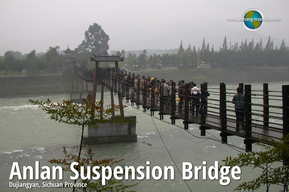
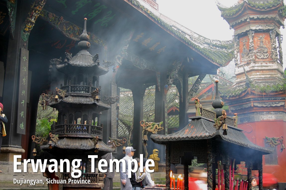
It is best to arrange with a travel agent in Chengdu or abroad to reach Dujiangyan. Visit includes a tour of the Erwang Temple and the Anlan Suspension Bridge. Tim and Chooi Yoke at Dujiangyan Irrigation System (19 October 2005)
List of World Heritage Sites in Sichuan Province and World Heritage Sites in China
 Latest updates on Penang Travel Tips
Discover with Timothy YouTube Channel
PG Food Channel
Learn Penang Hokkien YouTube Channel
SojiMart Videos
Share your travels and/or ask a travel-related question
Join the Penang Travel Tips Facebook Group to share photos, tips and anything related to your travels, or ask travel-related questions.
 Map of Roads in Penang
Looking for information on Penang? Use this Map of Roads in Penang to zoom in on information about Penang, brought to you road by road. Discover with Timothy
Let me take you to explore and discover Penang through my series of walking tours on YouTube. You may use these videos as your virtual tour guide. At the beginning of each video, I provide the starting point coordinates which you may key into your GPS, Google Maps or Waze, to be navigated to where I start the walk, and use the video as your virtual tour guide.Disclaimer
Please use the information on this page as guidance only. The author endeavours to update the information on this page from time to time, but regrets any inaccuracies if there be any.Latest from Discover with Timothy: Gurney Bay - what to see and do there
About this website

Hello and thanks for reading this page. My name is Timothy and my hobby is in describing places so that I can share the information with the general public. My website has become the go to site for a lot of people including students, teachers, journalists, etc. whenever they seek information on places, particularly those in Malaysia and Singapore. I have been doing this since 5 January 2003, for over twenty years already. You can read about me at Discover Timothy. By now I have compiled information on thousands of places, mostly in Peninsular Malaysia and Singapore, and I continue to add more almost every day. My goal is to describe every street in every town in Malaysia and Singapore.
Robbie's Roadmap
- Episode 1: Robbie's Journey to Financial Freedom
- Episode 2: Lost in America
- Episode 3: The Value of Money
- Episode 4: The Mentor
- Episode 5: The Thing that Makes Money
- Episode 6: The walk with a Billionaire
- Episode 7: The Financial Freedom Awakening
- Episode 8: Meet Mr Washington
- Episode 9: The Pizzeria Incident
Copyright © 2003-2024 Timothy Tye. All Rights Reserved.