
Changchun 长春
 Go Back - Latest PENANG Sights/Streets/New Properties > Malaysia > World | Hokkien : Lessons : Dictionary | YouTube | Facebook | About Me : Contact Me
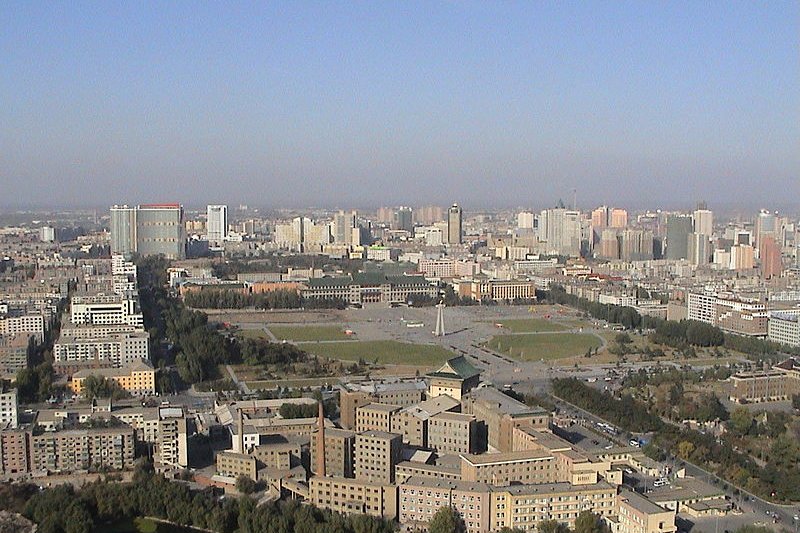
 Cultural Square, Changchun
Source: https://commons.wikimedia.org/wiki/File:Changchun_Cultural_Square.JPG
Author: Broboman

Changchun (长春) is the capital and biggest city in Jilin Province, China. This sub-provincial city covers 20,532 sq km (7,927 sq mi) with an urban area covering 3,616 sq km (1,396 sq mi). Changchun has an urban population of 3.6 million people and a sub-provincial city population of 7.5 million. It observes the China Standard Time, which is eight hours ahead of Coordinated Universal Time (UTC+8). The phone area code here is 0431.
Changchun is located in the Northeast China Plain. The city itself is at an elevation of about 300 m (985 ft) above sea level. The city experiences a humid continental climate with long, cold winters and hot, humid summers. The warmest month is July, when average temperature reaches 27.6°C (81.7°F). Winters are extremely cold, with average low temperature for January dropping to -19.7°C (-3.5°F). The heaviest rain falls in July, which receives 161 mm (6.34 in) of precipitation.
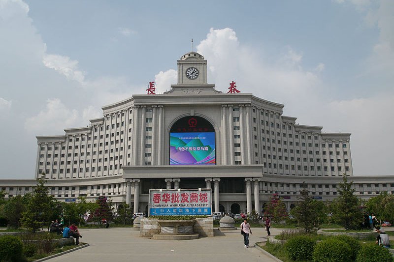
 Changchun Railway Station
Source: https://commons.wikimedia.org/wiki/File:Changchun_Railway_STation.jpg
Author: Angelo Puccini

The city of Changchun is subdivided into six district, three county-level cities and one county. It is a rapidly growing city with a 2007 GDP of ¥208.9 billion, a two-fold increase in five years. The industries based in Changchun include the largest automobile manufacturing facility in China, foodstuff, medicine and photo-electronic information.
Unlike other major cities in China, modern Changchun has quite a recent history, going back to 1800, when Emperor Jiaqing established it from a small village by the Yitong River. The area however has been settled for thousands of years, with different settlements existing there, including Xidu, Helong, Tiangang, Shushan, Longzhou and Kuancheng. Originally written as Hsinking under the old spelling, Changchun was connected by rail in 1898 when the Harbin-Lüshun branch of the Chinese Eastern Railway line was built.
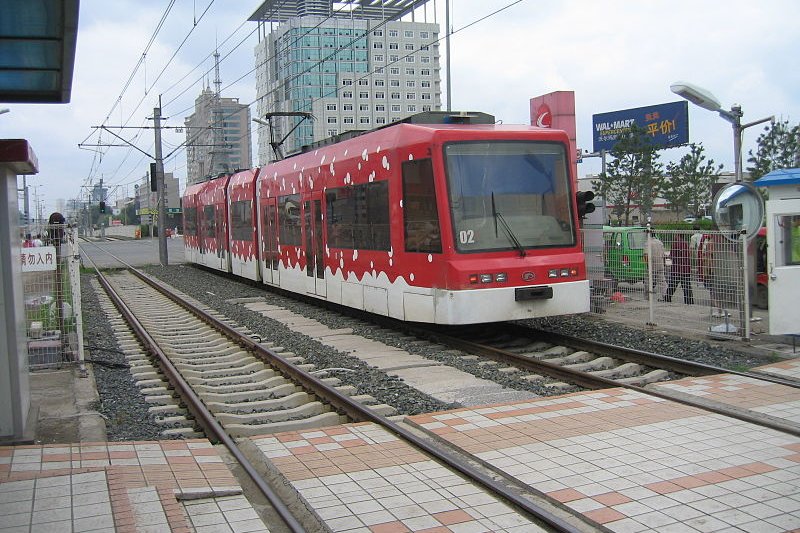
 Changchun Light Railway
Source: https://commons.wikimedia.org/wiki/File:Changchun_light_railway_red.jpg
Author: Song.li

The Russo-Japanese War of 1904-05 resulted in Hsinking being the border town between Russia-controlled Manchuria and Japan-controlled South Manchuria, or Manchukuo. In 1932, the Japanese relocated the capital of Manchukuo from Jilin City to Hsinking. The Japanese installed China's last emperor Pu Yi as the head of state of the Manchukuo government.
Changchun suffered heavy damage during the Second World War. It was then captured by the Soviet Red Army in 1945. The following year Kuomintang troops captured the city, only to lose it to Communist troops in 1948. The new Chinese government changed the Ropmanization from Hsinking to Changchun. The city has been the capital of Jilin Province since 1954. In 2007 it hosted the Winter Asian Games.
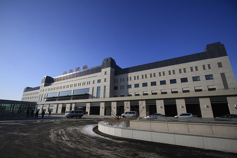
 Changchun West Railway Station
Source: https://commons.wikimedia.org/wiki/File:Changchun_West.JPG
Author: Heaveen

Planning your trip to Changchun
The Changchun Longjia International Airport (CGQ) is a new airport opened in 2005. It is 30 km to the east of downtown Changchun. The airport is served mainly by domestic flights, with a number of international flights from Seoul and Nagoya. Arriving here, you can take the coach bus to the city. Journey takes about 45 minutes and the fare is ¥30. Taxis charge at least ¥100 from the airport to the city, although in the other direction, the fare inclusive toll is just ¥80.Exploring Changchun
The city center of Changchun is sufficiently compact for exploring on foot. To go greater distances, it has an extensive bus network. In addition, there are minibuses, trams and a light rail transit, which presently has a single line.Places of Interest in Changchun
- Banruo Temple
- Changchun Film City
- Jingyuetan National Forest Park
- People's Square
- Puppet Imperial Palace
- South Lake
- Wenhua Square
 Latest updates on Penang Travel Tips
 Discover with Timothy YouTube Channel
 PG Food Channel
 Learn Penang Hokkien YouTube Channel
 SojiMart Videos
 Share your travels and/or ask a travel-related question
Join the Penang Travel Tips Facebook Group to share photos, tips and anything related to your travels, or ask travel-related questions.
 Map of Roads in Penang
Looking for information on Penang? Use this Map of Roads in Penang to zoom in on information about Penang, brought to you road by road. Discover with Timothy
Let me take you to explore and discover Penang through my series of walking tours on YouTube. You may use these videos as your virtual tour guide. At the beginning of each video, I provide the starting point coordinates which you may key into your GPS, Google Maps or Waze, to be navigated to where I start the walk, and use the video as your virtual tour guide.Disclaimer
Please use the information on this page as guidance only. The author endeavours to update the information on this page from time to time, but regrets any inaccuracies if there be any.Latest from Discover with Timothy: Gurney Bay - what to see and do there
About this website

Hello and thanks for reading this page. My name is Timothy and my hobby is in describing places so that I can share the information with the general public. My website has become the go to site for a lot of people including students, teachers, journalists, etc. whenever they seek information on places, particularly those in Malaysia and Singapore. I have been doing this since 5 January 2003, for over twenty years already. You can read about me at Discover Timothy. By now I have compiled information on thousands of places, mostly in Peninsular Malaysia and Singapore, and I continue to add more almost every day. My goal is to describe every street in every town in Malaysia and Singapore.
Robbie's Roadmap
- Episode 1: Robbie's Journey to Financial Freedom
- Episode 2: Lost in America
- Episode 3: The Value of Money
- Episode 4: The Mentor
- Episode 5: The Thing that Makes Money
- Episode 6: The walk with a Billionaire
- Episode 7: The Financial Freedom Awakening
- Episode 8: Meet Mr Washington
- Episode 9: The Pizzeria Incident
Copyright © 2003-2024 Timothy Tye. All Rights Reserved.