Without a doubt, taking the New York City subway is the best way to travel in New York City on a budget. Use it if the distance is too far to make walking practical. Otherwise, walk. You will be able to see a lot more, at a comfortable pace when you walk. However, as you are unlikely to have that much time to cover all the sights, take the subway whenever necessary. The fare is just US$2.00 no matter how far you travel. You can also buy the one-day FunPass for US$7.50, which allows you unlimited travel all day, or better still, the US$25.00 7-day unlimited ride MetroCard.
Taking the Subway in New York City
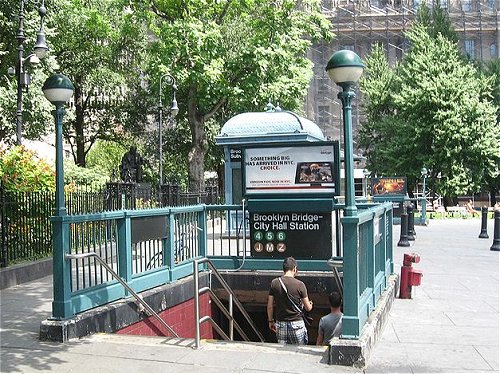
The New York City subway is easily the best way to travel around the city. It may look grungy and dirty, but few New Yorkers will trade their 24 hour, extensive, and fairly reliable subway system for a better looking one. The much-feared subway crimes of the 70s and 80s are for the most part a thing of the past, and it is almost always completely safe. Just use common sense when traveling late at night alone and try to use heavily-traveled stations. Nowadays you are more likely to get struck by lightning, statistically, than be the victim of the crime on the subway. Subway entrance, Brooklyn Bridge-City Hall Station
Source: https://commons.wikimedia.org/wiki/File:BB_City_Hall_IRT_stair_jeh.jpg
Author: Jim.henderson

Things to know about the Subway in New York City
- Every line is identified by either a letter or a number. Ignore the colors. Unless you restrict your subway use to the midtown area, relying on colors is a sure way to get lost.
- Uptown/downtown in Manhattan- Almost all lines in Manhattan go north/south and the direction is always clearly noted on the platforms and in train announcements. In general, 'Bronx-Bound' and 'Queens-Bound' are synonymous with uptown, while 'Brooklyn-Bound' is synonymous with downtown. Station entrances will also indicate the direction (e.g., "Uptown and the Bronx and Queens" or "Downtown and Brooklyn") so be careful when entering the station. If no direction is indicated, then you can use that entrance for both uptown and downtown tracks.
- Get the New York City Subway Map, also available at staffed token booths. Token booth attendants can also be very helpful in advising you which line to take to your destination. Here's a useful Subway Map that has been overlaid on top of google maps. It shows you exactly where the train stops (and entrances/exits for Manhattan). A useful map that finds the closest subway to any given address in New York City is available. Alternatively, use HopStop.com for directions on how to travel between two addresses in the city via subway, buses, regional rail, or walking based on your selection of fewer transfers and more walking, or less walking and more transfers.
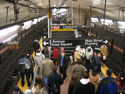
 New York City Subway at Grand Central Terminal
Source: https://commons.wikimedia.org/wiki/File:NYCSub_7_Grand_Central.jpg
Author: Dschwen

Important lines in Manhattan:
- The Lexington Avenue Line (4, 5, 6) are the only trains on the East Side above 23 St. Useful for the Metropolitan Museum of Art, Guggenheim Museum, and other east side museums (4, 5, or 6 to 86th Street Station or the 6 to 77th Street Station). Also for the Statue of Liberty (4, 5 to Bowling Green Station), Chinatown (6 to Canal Street Station), and Yankee Stadium (4, B, D to 161 St./Yankee Stadium Station).
- The Seventh Avenue Line (1, 2, 3) serves Broadway above 42nd Street, and Seventh Avenue below 42nd Street. Useful for the West Village, Chelsea, and Tribeca neighborhoods as well as the Staten Island or Statue of Liberty ferries (1 to South Ferry Station) and Columbia University (the 1 to 116th Street Station).
- The Eighth Avenue Line (A, C, E) serves Eighth Avenue between 14th and 116th streets, then St. Nicholas Av., Broadway, and Ft. Washington Av. starting at 125th St. in Harlem. Useful for the Natural History Museum (C to 81st Street Station), the west side of Central Park (the C makes local stops on Central Park West), Cloisters Museum (A to 190th Street Station), JFK Airport (A to Howard Beach or E to Jamaica).
- The Sixth Avenue Line (B, D, F, V) runs on 6th Ave. from West 4th St. to 57th St. (or to 47th-50th Sts. for all but the F), and is useful for accessing the Museum of Modern Art, Rockefeller Center, Radio City Music Hall, and St. Patrick's Cathedral (47th-50th Sts.); and Coney Island (Stillwell Av.). Grand St. on the B and D is the best all-purpose stop for Chinatown. The D train also converges with the 8th Av. Line from 59th St./Columbus Circle to 145th St., and is useful for traveling to Harlem, or to Yankee Stadium (161 St./Yankee Stadium).
- The Broadway Line (N, Q, R, W) runs down Broadway below 42nd Street and on Seventh Avenue above Times Square. The N, Q, R, and W trains are useful for accessing Chinatown (Canal St), SoHo/NoHo, NYU area, Union Square, the Empire State Building (34th St), Times Square (42nd St), Carnegie Hall (57th St.), Central Park (57th St and 5th Av stations), and the southern end of the Upper East Side. The R and W trains also go down to Financial District and South Ferry (Whitehall St).
 Latest updates on Penang Travel Tips

Copyright © 2003-2025 Timothy Tye. All Rights Reserved.

 Go Back