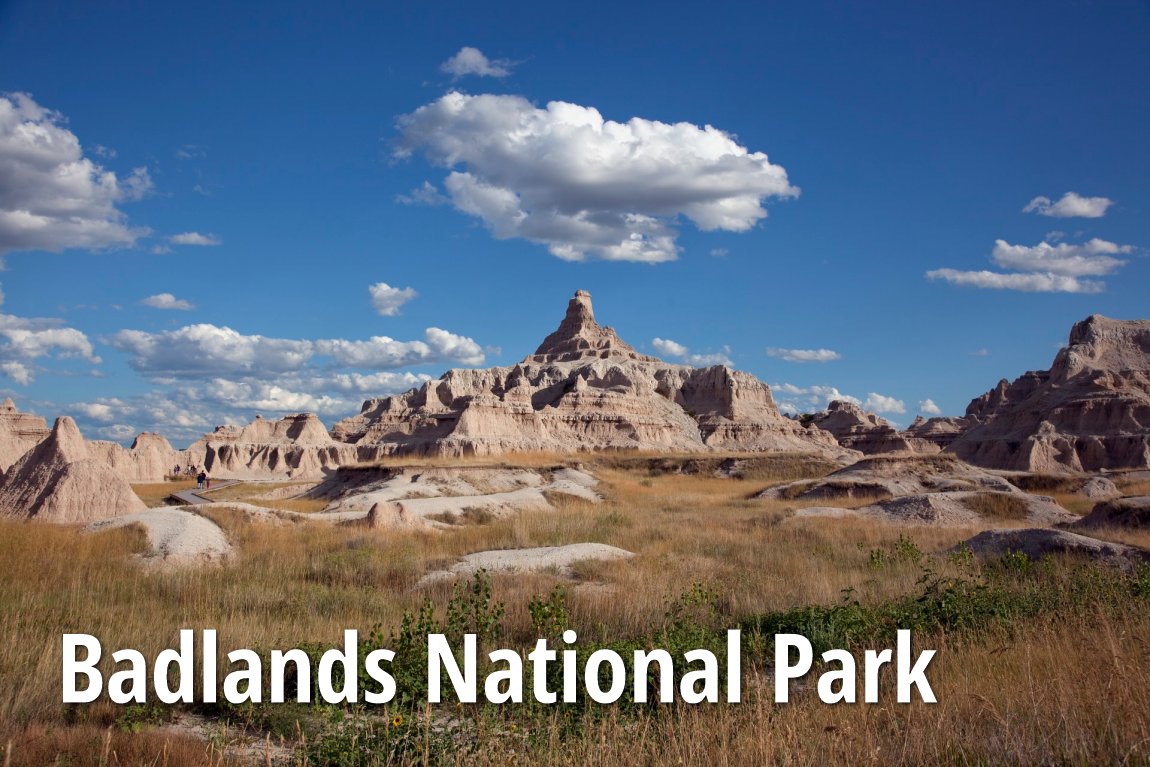

Badlands National Park
 Go Back - Latest PENANG Sights/Streets/New Properties > Malaysia > World | Hokkien : Lessons : Dictionary | YouTube | Facebook | About Me : Contact Me
 Badlands National Park
 https://commons.wikimedia.org/wiki/Category:Badlands_National_Park#/media/File:Badlands_National_Park,_South_Dakota,_04594u.tif
 Carol M. Highsmith
Badlands National Park is a US national park in southwest South Dakota. It covers 242,756 acres (982 sq km), of which 64,250 acres is a designated wilderness area.
The landscape of Badlands National Park is one of sharply eroded buttes, pinnacles and spires. It was established at a national monument on 29 January, 1939, and elevated to national park on 10 November, 1978.
Badlands National Park contains the world's richest Oligocene epoch fossil beds, dating 23 to 35 million years old. Through studying the fossils in the Badlands formations, scientists can learn about the evolution of mammal species such as the horse, sheep, rhinoceros and pig.
Native Americans have used the Badlands area for over 11,000 years as their hunting grounds. Their descendents live today in North Dakota.
According to archaeological records as well as oral traditions, the indigenous people lived in secluded valleys where fresh water and game were available year round. Traces of rocks and charcoal from their campfires have been found eroded from the stream banks today. Also discovered are ancient arrowheads and tools used to butcher bison, rabbits, and other game.
Homesteaders started moving into South Dakota towards the end of the 19th century. During that time, the US government forcefully removed the Native Americans from much of their territory and compelled them to live on reservations.
In the fall and early winter of 1890, thousands of Native American became followers of a Native American prophet named Wovoka. He called upon the native people to dance the Ghost Dance and wear Ghost Shirts, which he said would be impervious to bullets. Wovoka predicted that the white man would vanish and their hunting grounds would be restored.
In the ensuing confrontation between the Plains Indians and the US military took place at Wounded Knee, South Dakota. Nearly two hundred Indians and thirty soldiers were killed. The massacre was the last major conflict with the US military until the advent of the American Indian Movement in the 1970s.
Wounded Knee is not within the boundaries of Badlands National Park. It is located approximately 45 miles (72 km) south of the park on Pine Ridge Reservation. The U.S. government and the Oglala Lakota Nation have agreed that this is a story to be told by the Oglala of Pine Ridge and Minneconjou of Standing Rock Reservation. The interpretation of the site and its tragic events are held as the primary responsibility of these survivors.
Visiting Badlands National Park
Interstate 90 running north of Badlands National Park provides access to the Badlands Loop Road. If you are traveling along the I-90 from the east heading west, take Exit 131 and follow signage to reach the northeast entrance gate to the national park. If you're coming from the west heading east, take Exit 110 at Wall, then follow the signage to reach the Pinnacles entrance to the park.While Badlands National Park is open all year round, 24 hours a day, the visitor center is open 8:00 am to 4:00 pm in winter, 8:00 am to 5:00 pm from mid April to mid May, 7:00 am to 7:00 pm in the summer, and 8:00 am to 5:00 pm from early September to late October.
Admission pass to Badlands National Park is $15 per non-commercial vehicle, $7 per person on foot or bicycle, and $10 per motorcycle. The pass is good for 7 days.
List of National Parks in the United States
 Latest updates on Penang Travel Tips
 Discover with Timothy YouTube Channel
 PG Food Channel
 Learn Penang Hokkien YouTube Channel
 SojiMart Videos
Latest from Discover with Timothy: Gurney Bay - what to see and do there
About this website

Hello and thanks for reading this page. My name is Timothy and my hobby is in describing places so that I can share the information with the general public. My website has become the go to site for a lot of people including students, teachers, journalists, etc. whenever they seek information on places, particularly those in Malaysia and Singapore. I have been doing this since 5 January 2003, for over twenty years already. You can read about me at Discover Timothy. By now I have compiled information on thousands of places, mostly in Peninsular Malaysia and Singapore, and I continue to add more almost every day. My goal is to describe every street in every town in Malaysia and Singapore.
Robbie's Roadmap
- Episode 1: Robbie's Journey to Financial Freedom
- Episode 2: Lost in America
- Episode 3: The Value of Money
- Episode 4: The Mentor
- Episode 5: The Thing that Makes Money
- Episode 6: The walk with a Billionaire
- Episode 7: The Financial Freedom Awakening
- Episode 8: Meet Mr Washington
- Episode 9: The Pizzeria Incident
Copyright © 2003-2024 Timothy Tye. All Rights Reserved.