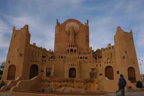
 M'Zab Ghardaia, Algeria
Source: https://commons.wikimedia.org/wiki/File:Mzab_Gharda%C3%AFa.jpg
Author: PhR61

M'Zab Valley (GPS: 32.48511, 3.68067) is a limestone plateau in the northern Sahara of Algeria that was inscribed a World Heritage Site in 1982. M'zab Valley is famous for its traditional abodes built by the Ibadite people in the 10th century. There are five walled villages called ksour at Wad Mzab which are suited to the environment while ideal for the family structure. The well preserved abodes supported by the intact customs and lifestyle of the people was the reason that M'Zab Valley was inscribed as a World Heritage Site during the 6th session of the World Heritage Committee, which met on 13-17 December, 1982 in Paris.
The villages of M'Zab Valley do not stay within their dwellings throughout the year. During summer, they migrate to "summer citadels" around palm grove oases. These oases are within the Sahara Desert and are surrounded by an arid country known as chebka.
The nature of the Ibadite society has helped to preserve their customs and social life. A council made up of representative from the seven walled villages decide on religious, social and cultural matters.
What to See in M'Zab Valley
The five walled villages, or ksour, are the highlight of M'Zab Valley. The villages are called Tagherdayt, Beni Isguen, Melika, Bounoura and El-Ateuf. Two more villages, Berianne and El Guerara are two more recent settlement added to the group. Each walled village has its own mosque, built like a fortress, with its minaret double as watchtower. The residences are built in concentric circles around the mosque.Location of M'Zab Valley
M'zab is within the Ghardaïa province of Algeria, 600 km from Algiers.M'Zab Valley World Heritage Site Inscription Details
Location: N32 28 59.988 E3 40 59.988Inscription Year: 1982
Type of Site: Cultural
Inscription Criteria: II, III, V
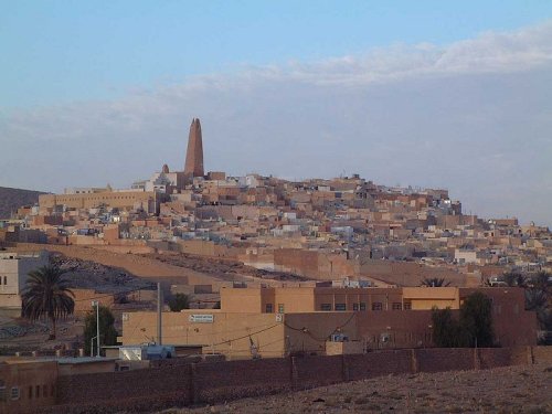 Ghardaia, Algeria
Source: https://commons.wikimedia.org/wiki/File:Ghardaia_01.jpg
Author: Taguelmoust

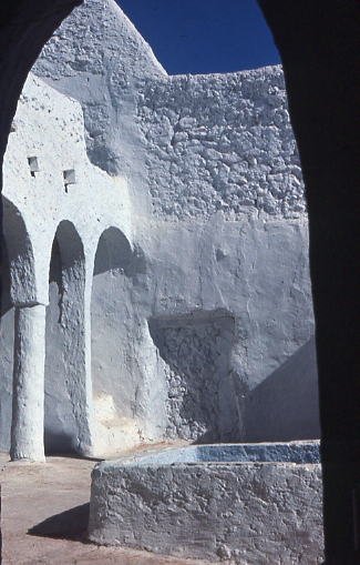 Beni Isguen, Algeria
Source: https://commons.wikimedia.org/wiki/File:B%C3%A9ni_Isguen,_maison_de_la_palmeraie.jpg
Author: Michel-georges Bernard

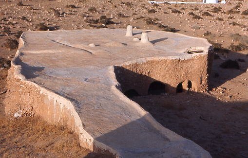 The mosque at El Ateuf, Algeria
Source: https://commons.wikimedia.org/wiki/File:El_Atteuf,_mosqu%C3%A9e.jpg
Author: Michel-georges Bernard

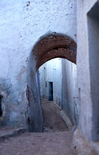 Ghardaia, Algeria
Source: https://commons.wikimedia.org/wiki/File:Gharda%C3%AFa,_rue.jpg
Author: Michel-georges Bernard

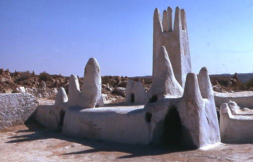 Cheikh Sidi Aissa Mausoleum, Algeria
Source: https://commons.wikimedia.org/wiki/File:M%C3%A9lika,_mausol%C3%A9e_de_Cheikh_Sidi_Aissa.jpg
Author: Michel-georges Bernard

List of World Heritage Sites in Algeria
 Latest updates on Penang Travel Tips
 Discover with Timothy YouTube Channel
 PG Food Channel
 Learn Penang Hokkien YouTube Channel
 SojiMart Videos
Latest from Discover with Timothy: Gurney Bay - what to see and do there
About this website

Hello and thanks for reading this page. My name is Timothy and my hobby is in describing places so that I can share the information with the general public. My website has become the go to site for a lot of people including students, teachers, journalists, etc. whenever they seek information on places, particularly those in Malaysia and Singapore. I have been doing this since 5 January 2003, for over twenty years already. You can read about me at Discover Timothy. By now I have compiled information on thousands of places, mostly in Peninsular Malaysia and Singapore, and I continue to add more almost every day. My goal is to describe every street in every town in Malaysia and Singapore.
Robbie's Roadmap
- Episode 1: Robbie's Journey to Financial Freedom
- Episode 2: Lost in America
- Episode 3: The Value of Money
- Episode 4: The Mentor
- Episode 5: The Thing that Makes Money
- Episode 6: The walk with a Billionaire
- Episode 7: The Financial Freedom Awakening
- Episode 8: Meet Mr Washington
- Episode 9: The Pizzeria Incident
Copyright © 2003-2024 Timothy Tye. All Rights Reserved.


 Go Back